 1300 436 332
 Email Us
 Find the nearest MADEC
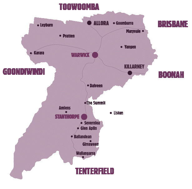
The cool, high country of the Stanthorpe region is located on Queensland’s southern border and the northernmost part of the New England Tablelands. The region is known as the Granite Belt due to the spectacular granite rocks found in the area.
At 811m above sea level, the Granite Belt delivers four seasons a year where you can experience snowfall in winter, beautiful mild spring and autumn days, and sunny warm summers.
Girraween National Park is known for its spectacular flowers, dramatic landscapes and unique wildlife, with bushwalking and rock climbing the most popular activities in the park.
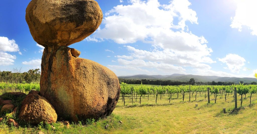
With a mostly rural population of around 5,500 Stanthorpe is well recognised for its wineries and wide variety of fresh produce. Wine and table grapes, apples, strawberries, olives, figs, cherries, and a variety of vegetables are grown and there are complementary industries including cheese and chocolate making, and lavender farms.
The bi-annual Apple and Grape Harvest Festival is a major feature every two years, and both Opera and Jazz festivals are held in the wineries and are sold out events.

Stanthorpe is an ideal destination for a short or long holiday, but with around 38% of industry focussed on agriculture, there is plenty of harvest work to be had most of the year.
If you are looking for harvest related work in the area, contact the Harvest Office in Stanthorpe on 07-46816201.
Other valuable sources of local information are the Visitor Information Centres at Stanthorpe and Warwick:
Stanthorpe Visitor Information Centre
28 Leslie Parade, Stanthorpe
07 4681 2057
Stanthorpe Visitor Information Centre Facebook
Monday — Sunday, 9am – 4pm
Warwick Visitor Information Centre
Town Hall, 72 Palmerin St, Warwick
07 4661 3122
Warwick Visitor Information Centre Facebook Page
Monday — Friday: 9am – 5pm
Saturdays: 9am – 4pm
Sundays: 9am – 2pm